On our Indian Ocean travels, we became accustomed to foreign cruisers approaching us to discuss sailing down the South African Coast. Its notoriety is well known. It is a difficult coastline, the continental shelf lies very close to shore for large stretches of the coast, this together with the warm current which flows down the coast, at times at 4 – 6 knots, creates quite a maritime challenge. I have heard the area compared with the Burmuda Triangle. Ships “disappear” (the Waratah has never been found), bulk oil carriers report seeing and being engulfed by monster rogue waves and all of the nautical charts warn of abnormal waves, especially after a strong Southwesterly blow which happens at the tail end of the low pressures which scuttle past the Cape. These move South during the summer months but still have an influence on the conditions along the coast. After a southwesterly breeze, the swell moves against the strong current creating steep waves with a short wavelength and huge troughs that most ships and all small sailing yachts strive to avoid.
The Piracy along the African East Coast has obliged the global cruising community (an annual rotation of sailing nomads) to head South around the Cape of Good Hope in order to complete a circumnavigation, many of these cruisers have been following Trade Wind routes and have not had to contend with the severe sailing conditions found along the South African Coast on their travels, and so are justifiably wary of this leg of their journey.
We enjoyed the many discussions about “our” coastline, but did not feel any less wary ourselves. If you do not pick the right weather moment you could be in for a rather unpleasant experience. Jeremy and I have both been party to yacht club discussions on the subject of sailing the coast over the years and Jeremy has sailed a few of the Vasco Da Gama races from Durban to East London. On one of these a yacht called the Rubicon disappeared without trace. Most South African sailors have a story or two to tell about rogue waves, unpleasant sea states, 6 knots of current, the most recent story being sthat of a catamaran from Cape St Francis being flipped on the Aghullas Bank.
With this in mind we left Reunion Island with the intention of making South African landfall in Port Elizabeth, since Jeremy’s parents live there and we wanted to spend time with them. Our other motivation was to try and avoid the Transkei Coast between Durban and Port Elizabeth. Half way through our passage to Port Elizabeth our weather files gave indication of a strong Southwesterly blow moving up the coast.This was confirmed by friends ashore who were weather routing for us, and we changed our heading towards Durban. Had we not we would have been caught in one of the seasons big system. The steep low pressure system grew into a “Cut Off Low”, feeding rain and strong winds up the coast creating large swells and all sorts of weather havoc.
We skirted the upper extremes of that low, expecting and being prepared for a 30 to 40 knot breeze. What actually arrived was 25 knots and a steep sea state, just outside of Durban meaning the low was moving East faster than expected which was in our favour. We finally made landfall in the port of Durban on the morning of the 21st of November.
DURBAN
As we approached, I radioed Durban Port on VHF:
“ Durban Port Control, Durban Port Control, this is the yacht Jerrican, Jerrican . . . .we are a South African flagged yacht, last port of call Reunion Island, request permission to enter the port”
The radio operator responded positively inquiring as to how we had found the weather out there.
This was followed by a warm “Welk Kum Home” in a most heart warming “Cape accent”. I felt like weeping with both patriotic pride and sheer relief at being HOME on SA soil!
This relief was short lived, however, because looming ahead of us was still the dreaded Transkei Coast, Mbashe Point and the final leg after that from East London, past the southern most tip of Africa, The Cape Aghullas and the dreaded Aghullas Bank, an area of the continental shelf which juts out into the current, resulting in a sharp decrease in depth and the formation of occasional “abnormal waves” at times.
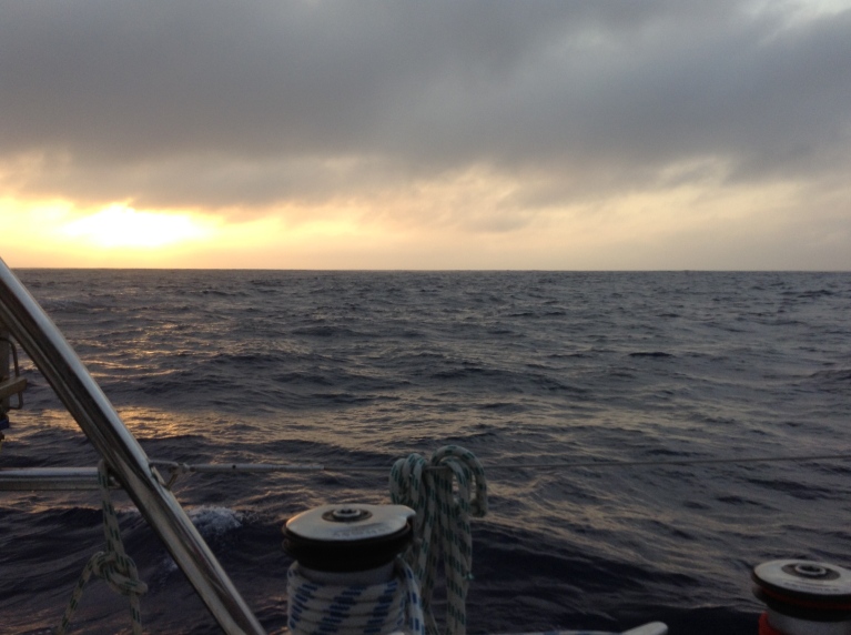
We waited out in Durban for the weather to turn for a week, finally leaving in a light Northeasterly. The coast dropped away from us as we headed out into the current, finding the current just off the 200 metre depth contour where we sailed comfortably and fast along the coast with the current behind us, until the wind turned Southwest a little earlier than expected.
EAST LONDON
We headed into the Port of East London to allow the Southwesterly system to pass through. It was an easy decision to do so even though we were just a 120nm from Port Elizabeth . . . the wind had turned Southwest . . . besides we have a good friend living there.
Graham met us on the jetty in the declining light of evening with a flash light and caught our ropes.
Graham and his partner Marian spoilt us with a lovely”braai” and we conducted a nostalgic tour of the City of a East London with a car they kindly lent to us during our 3 days stay there.
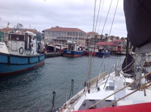
East London Port is the only Natural Harbour on the South African coast, and entry into its harbour, the mouth of the Buffalo River, is easy. The working jetty on the wharf side is a little difficult but anchoring is very good and many cruisers anchor in the port while waiting out weather. We were sad to see the decline of Latimers Landing, a small waterfront development that at one point was a thriving Restaurant precinct. Fortunately there are still fairly acceptable showers!
Our friend Graham related a story of a lone sailor who arrived weather beaten into the harbour in East London with a huge dent in his steel boat which needed repairs. He claimed to have been broad sided by a huge wave which dented the 5mm steel of the yacht just off the coast of East London, yet another reminder to treat the sailing of our coast with respect.
With the weather again favourable we departed East London harbour having submitted our “Flight Plan” to the harbour authorities. Shortly afar leaving the port, East London Port Control called us on VHF radio with a question as to the identity of the yacht behind us which was attempting to leave without lodging a flight plan. The French Flagged yacht was hauled back by the coastal patrol boats to do just that.
The filing of a flight plan is a requirement along the South African Coast and although a bit of a hassle, is a measure I do not begrudge. I find this a comfort, given that boats have in the past simply disappeared!
It is reassuring to know too that the Flight Plans are not simply an annoying formality and are in fact passed on from one port to the next . . . when we entered East London the Port Authorities wanted to know why we had not landed in Port Elizabeth since our flight plan submitted in Durban had stated as such. Naturally they understood our reference to a Southwester!
PORT ELIZABETH
We sailed into Port Elizabeth with the wind behind us and found our way easily into the marina. The Algoa Bay Yacht Club was the club where Jeremy and I met so it was much like the closing of a very large circle of life events. We both felt very nostalgic. The club house has fantastic facilities, although it is difficult (like East London) to get around as a cruiser without transport. We borrowed a car from Jeremy’s sister and spent time with family and old friends.
The unfortunate thing about Algoa Bay Yacht Club is the Manganese Ore Loading site which lies a few hundred metres upwind from the marina. We found we needed to limit our time there due to this, the ore just gets into everything, so we left a little earlier than our weather files advised, feeling that this was an acceptable risk as we were headed for Port St Francis, the small harbour in St Francis Bay, one hour drive from the City of Port Elizabeth. The passage was supposed to be a short 8 hour hop, but ended up being a 24 hour beat into a dreaded, although light SouthWesterly blow. We zig zagged from close inshore St Francis Bay and off shore to where we found some current. We beat comfortably through the night with the assistance of the dreaded current into St Francis Bay.
We scissored our way into St Francis Bay and motored the last 20 miles, into the winds, since the harbour entrance lies in the Southwesterly corner of the bay.
PORT ST FRANCIS
Port St Francis is a working fishing harbour, which does not ordinarily welcome sailing visitors. We have another old sailing friend living in the area and he arranged a spot for us. The harbour master met us in a small boat at the tricky entrance and guided us in to a very comfortable mooring. We planned to spend a few days here to wait out the southwester, for our final weather window to Simon’s Town. It is always lovely landing in a place with some familiar faces and we enjoyed dinner with our friends Frans and Tania. While on the marina for three nights, we watched Cape Clawless Otter stealing bait fish from the fishing boats and playing on the marina rocks and the many “Chokka Boats” offloading their catches and changing crews twice a day. I loved our stay here. The sea temperature was dropping, the sea life was beginning to resemble that of the Cape Coast and the vegetation takes on the typical small leaved and scented characteristics of the Cape “fynbos” flora. We walked along the long beach at Cape St Francis, over pristine dunes and rocks covered with orange lichen. I began feeling that we were closing in now, on our home port of Simon’s Town . . . just the last hurdle, the last 400 nautical miles to Cape Town, rounding the Cape Aghullas and the inevitable strong Southeasterly blast into False Bay!
Our weather window arrived and we said our farewells to our very dear friends and set off in light winds towards Cape Aghullas. Weather files predicted a very light southwesterly blow and we made our plans for a “bail out” in the event it turned into a stronger than expected breeze. Our “bail out plans” included an anchorage off the Robberg Peninsula, the harbour in Mossel Bay and as we got closer to Aghullas, the anchorage in Struis Baai, all good safe havens should the Southwesterly become unmanageable and threatening. It stayed mild and moderate though and we rounded Cape Aghullas in idillic conditions early on the 15th of December as the winds backed to the South and then to the South East. From here we turned West North West and then North North West towards the Cape. The water temperature dropped significantly and we trailed lines in the hopes of catching a yellowtail or a tuna. No luck on the fish front but we enjoyed the feeling of being in Cape Waters. Gannets circled the boat, swooping low enough for us to see their blue circled eyes and we surprised a sleeping Cape Fur Seal which made me irrationally (almost hysterically) happy! I felt such love for that seal as it gasped and dived and then popped up a little away from the boat, staring at us with glassy eyes. Being alone on watch at that point I wanted to scream with joy!
FALSE BAY AND SIMON’S TOWN
With the wind on our “good” quarter we enjoyed superb sailing towards Cape Hangklip and Cape Point, the two entrances to the beautiful False Bay (There IS nothing like home waters!).
Just off Cape Hangklip we sailed into what looked like a huge bait ball of sea activity. Birds diving, small fish jumping out of the way of larger predators, seals and a huge pod of Dolphins which stayed with us for four hours, playing in our bow and racing up from behind us to play in the movement of water off the transom. I revelled in the thrill of the “aliveness” of the colder and abundant waters of the Cape. As the sun slipped away the lights of the Danger Point, Cape Hangklip and Cape Point Lighthouses began their communication with ships at sea. The Southeaster wind picked up to a typical 25 to 30 knots and we sailed into False Bay under a reefed Genoa. Just perfect! We were home and Jeremy and I enjoyed a quiet moment basking in the glow of the knowledge that our crazy “shake down” journey through the Indian Ocean had come to an end, safely. Our last hurdle, docking with emotions running high at 2am in the morning was as expected . . . emotional . . . our noisy landing was full of differing opinions as to how we should be tying on to the jetty.
We arrived home on the 16th of December 2014, just in time for Christmas, 9000 nm, 5 months and 1 week after our departure in July.





First of all, RESPECT!!! Sailing not ways as idyllic as it seems . Quite interesting how organised SA still is with sailing plans having to be submitted . Comforting for sure . I hope to some day hear you guys talk ( and do an old school slideshow) of your expedition . You must be so proud x
LikeLike
Thank you Leonie!
LikeLike